

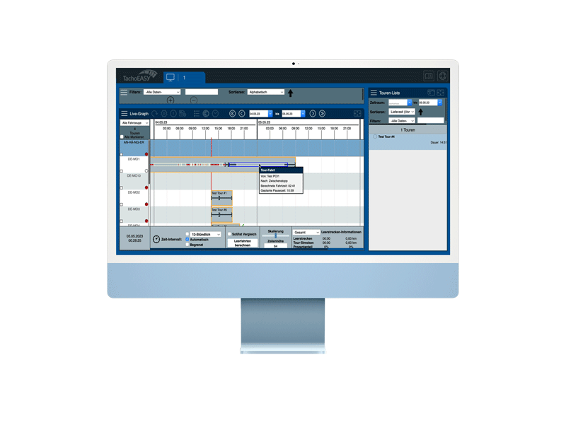
Real time scheduling
With the "Real-Time scheduling" module, tours can be monitored and edited in real-time. The live graph is the centerpiece of this module. The graph lists all available vehicles in rows on the left ...

Track & Trace
Where are my vehicles? Are the prescribed routes being followed? TachoEASY provides answers to these and many other questions with the Track & Trace feature. Using top-o...

Vehicle calendar
The vehicle calendar provides a clear overview of cleanings, workshop stays, etc., in a color-coded calendar. Here, mainly unavailabilities are listed, which are also visible in real-time schedulin...

Live-Ortung
There is no translation available. Wo befindet sich die Flotte, wie ist die Restlenkzeit? BlueLOGICO informiert Sie annähernd live über den Zustand Ihrer Fahrzeugflotte. Sie sehen auf einen Blick,...